Peak Bagging
Most mountain runners do this, and it isn't a new idea. When you start logging where you have been, or crossing mountain peaks off of your "to do" list you will get a nice feeling of accomplishment. Here on the #beastcoast the AMC (Appalachian Mountain Club) has a few established goals we can work towards including the New England 100 highest, New England 4k's, and the White Mountain 4k's. Their website is listed below, you're welcome.
Along with bagging peaks, you can get creative (there's that word again) and make your own goals. town bagging, state bagging, or chasing after FKT's or "Fastest Known Times" (The proboard forum style website is the authority on the matter. also linked below). Since there isn't much hope for myself to grab one of these records, I'll stick to the shorter, less exciting Strava "course records".
Geocaching & Shed Hunting?
This Summer my Stepdaughter introduced me to geocaching, and of course I got addicted to it and was hunting down caches during every trail run. This was totally cool with me since I was exploring new trails, and getting that satisfaction of collecting caches. Unfamiliar? That website is listed below as well (courtesy of D&L NightHawk). Shed hunting is something I stumbled upon this week while I was running the Fort Dix tank trails. I picked up a small two point deer antler, and now I will likely run into the back of a truck in the near future because I am constantly looking at the ground. As it would turn out this is a fringe pass time, and since I am a non hunter it's the only way to add a little rustic charm to my home decor. I urge you to check your local laws before you start meandering around picking up dead animal parts.
Libby finding her trade in a geocache in Willow Park (Bennington, VT)
Antler I found on the side of the trail in Pemberton, NJ
Heat Maps!
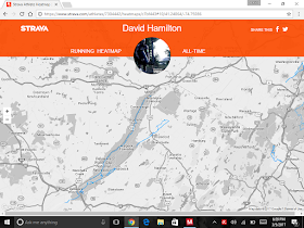
Today my long(ish) run was supposed to serve as a fitness test to see if I could hang at the Breakneck Point 21K in late April. Unfortunately, Breakneck was sold out, so I took a leisurely run adding to my "heat map". This is another addiction of mine (noticing a pattern here?) that keeps me honest in logging outdoor miles in new and interesting locations. This feature is available for Strava premium members. The website takes all of your lifetime GPS tracks and lays them out on a map, routes you have run/ridden more than once darken, and routes that you have run/ridden often show up in red. If you need a visual image to feel accomplished I recommend checking it out! This feature alone, has kept me off of the treadmill better than anything else. Below is a few shots from March 5th and bunch of screenshots of my favorite heat maps.
USGS marker on Sunrise Mountain near Branchville, NJ
Panoramic shot sitting on the summit Cairn
14 Mile loop around Stokes State Forest Near Branchville, NJ. Returning
on The Appalachian Trial.
The Delaware Water Gap has been a favorite spot of mine. Above
Is the Mcdade & Appalachian trails along with others.
Home Sweet Home HeatMap
21 Day work assignment in Bremerton, WA
Best Running Deployment San Juan Mountains
Silverton/Durango, CO
Island Hopping for Uncle Sam
Zoomed out Garden State, the Southern Stretch
is the Batona Trail a 54 mile footpath
through the NJ Pine Barrens.
The area surrounding my "Home Away From Home"
Most of New England, RI/CT is minimally tracked
Tri State area zoomed out
That's it for now. Maybe next week I will talk about my pack rat nature of hanging onto race "junk" and trinkets. I'll share my favorite shirts, awards, and crap I have picked up on the trail!
https://www.strava.com/athletes/7304442/heatmaps/c7bf443#2/40.97990/-45.00000
http://www.amc4000footer.org/the-lists-we-recognize.html
http://fastestknowntime.proboards.com/
http://www.geocaching.com


No comments:
Post a Comment